Whitsunday Island
The largest of the 74 Whitsunday Islands and home to Whitehaven Beach and Hill Inlet. All of it is national park, reached only by boat or air. Facts, beaches, walks, camping and the Ngaro Track.


Whitsunday Island Facts
Whitsunday Island is the island most visitors to the Whitsundays come to see. Whitehaven Beach runs down its eastern side and Hill Inlet sits at the northern end of the beach. There is no resort, no town and no public ferry: the whole island is national park.
| Fact | Detail |
|---|---|
| Size | About 109 km², the largest of the 74 Whitsunday Islands |
| Residents | None |
| Protected area | Whitsunday Islands National Park, established 1944, inside the Great Barrier Reef World Heritage Area |
| Distance | About 25 km east of Airlie Beach |
| Highest point | Whitsunday Peak, 437 m, above Cid Harbour |
| Famous for | Whitehaven Beach (7 km of 98% silica sand) and Hill Inlet |
| Anchorage | Cid Harbour, a large sheltered harbour on the western side |
| Access | Boat or air only. No resort, shops, fresh water or public ferry. |
| Named | By Captain James Cook, June 1770 |
| Traditional Owners | The Ngaro people |
Places On Whitsunday Island
| Place | Where and what |
|---|---|
| Whitehaven Beach | East side. 7 km of white silica sand, with the day-use area, camping and the Solway Passage lookout at the south end. Whitehaven Beach facts |
| Hill Inlet | North end of Whitehaven Beach. The swirling sands, seen from the lookout on Tongue Point. Hill Inlet facts |
| Tongue Bay and Tongue Point | Where boats land for the Hill Inlet lookout walk, with Lookout Beach and Betty's Beach nearby |
| Chance Bay | South-east corner. A quiet bay reached by a walking track from Whitehaven Beach, with a camping area |
| Cid Harbour | West side. A large, sheltered anchorage with Sawmill, Dugong, Naris and Joes beaches, camp sites and the Whitsunday Peak track. A known shark attack site: do not swim here. |
| Cairn Beach | Northern end, on Hook Passage. Fringing reef for snorkelling, a camp site and the start of the Whitsunday Cairn climb |
How To Get To Whitsunday Island
There is no public ferry to Whitsunday Island. Visitors arrive on a tour, a sailing trip, a scenic flight, a camping transfer or their own boat. Is there a Whitehaven Beach ferry?
| Option | Detail |
|---|---|
| Day tour from Airlie Beach | The most popular way. Fast boats reach Whitehaven Beach or Tongue Bay in about 1 to 2 hours, and most tours add a snorkel stop. Whitehaven Beach tours |
| Tour from Hamilton Island | Half-day and full-day tours leave Hamilton Island daily, about 30 to 40 minutes by boat. Hamilton Island tours |
| Overnight sailing trip | Most 1 to 3 night trips visit Whitehaven Beach or the Hill Inlet lookout, and many anchor in Cid Harbour. Overnight tours |
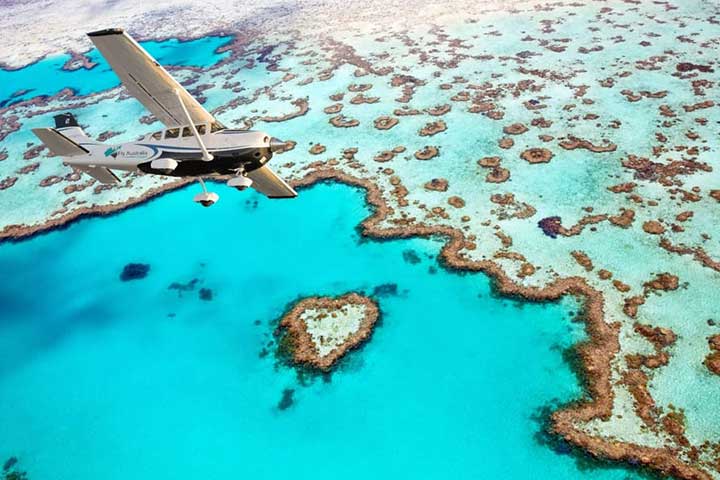
| Scenic flight | Planes and helicopters fly over Whitehaven Beach and Hill Inlet, and some helicopter trips land on the beach. Scenic flights |
| Camping transfer | Boat drop-offs to the national park camp sites. Camping in the Whitsundays |
| Own or hired boat | Cid Harbour is the main sheltered anchorage. The eastern side, including Whitehaven Beach and Tongue Bay, is exposed to the south-east trade winds. Boat and yacht hire |
Walks On Whitsunday Island
| Walk | Detail |
|---|---|
| Hill Inlet Lookouts | About 1.4 km return, 40 minutes, easy to moderate. From Tongue Bay to the lookouts above the swirling sands. |
| Lookout Beach | 500 m return, 20 minutes. A side track down to the beach at the mouth of Hill Inlet. |
| Solway Circuit | 1.2 km circuit, 40 minutes, moderate. From Whitehaven Beach up to a rock platform over Solway Passage. |
| Chance Bay | 3.6 km return, 2.5 to 3 hours, moderate. Branches off the Solway Circuit through forest to Chance Bay. |
| Dugong to Sawmill | 3 km return, 1 hour, easy to moderate. Joins two Cid Harbour beaches. Expect wet feet crossing Sawmill Creek near high tide. |
| Whitsunday Peak | 5 km return, about 4 hours, difficult. From Sawmill Beach to the highest point on the island, with views over the whole group. |
| Whitsunday Cairn | 4 km return, 3 hours or more, difficult. From Cairn Beach; there is no defined track, so follow the triangle markers. |
| Ngaro Track | 32 km over three days, bookings essential. See below. |
Walk details: Queensland Parks and Wildlife Service. Carry water on every walk; there is none on the island.
The Ngaro Track
The Ngaro Track is the only multi-day walk in the Whitsunday Islands. It crosses Whitsunday Island from Whitehaven Beach to Hill Inlet and opened to its first walkers in 2026. It was built by Queensland Parks and Wildlife Service with the Ngaro people, and artworks and signs along the way tell their story.
| Fact | Detail |
|---|---|
| Length | 32 km, one way |
| Time | 3 days and 2 nights |
| Route | South Whitehaven Beach to Tongue Point at Hill Inlet, via rainforest, Whitsunday Craig and the only mangrove boardwalk in the Whitsundays |
| Camps | Two purpose-built camps, reserved for Ngaro Track walkers |
| Numbers | Capped at 15 walkers per section per day |
| Ways to walk | Independently (book through the official Ngaro Track website, arrange your own boat transfers and carry your gear), or on a guided walk with World Expeditions, either full pack or fully catered |
| Best time | The cooler, drier months, about April to October |
| Day walkers | The track is not open for day use. Walkers without a booking can still use the Whitehaven Beach and Hill Inlet tracks. |
Camping On Whitsunday Island
| Camp area | Detail |
|---|---|
| Whitehaven Beach | South end of the beach. The most popular camp site; 10 sites, 36 people maximum. |
| Chance Bay | South-east corner, linked to Whitehaven Beach by a walking track |
| Dugong Beach, Sawmill Beach, Naris Beach, Joes Beach | Cid Harbour, on the sheltered western side. Shark warnings apply: do not swim. |
| Cairn Beach | Northern end, on Hook Passage, with fringing reef close to shore |
Camping permits must be booked and paid for in advance and the tag displayed. Facilities are basic, usually toilets and picnic tables at most. Bring all food and water, use a gas or fuel stove (no fires or generators) and take all rubbish back to the mainland. Camping in the Whitsundays
Tours To Whitsunday Island
Safety And Rules
| Topic | Detail |
|---|---|
| Marine stingers | Stinger season is November to May. Wear a stinger suit in the water. |
| Sharks | Cid Harbour is a known shark attack site. Sharks are present all year in the open ocean, estuaries, creeks and streams. |
| Water and shade | There is no drinking water on the island. Carry plenty and wear a hat and sunscreen. |
| Phone coverage | No mobile reception at Whitehaven Beach or Tongue Point |
| Fires and generators | Not permitted |
| Dogs | Not permitted on national park islands |
| Rubbish | There are no bins. Take everything back to the mainland. |
| Fishing | Not allowed in Marine National Park (green) zones, including Whitehaven Beach |
Whitsunday Island Questions
Is Whitehaven Beach on Whitsunday Island?
Yes. Whitehaven Beach runs for 7 km down the eastern side of Whitsunday Island, with Hill Inlet at its northern end.
Is there a ferry to Whitsunday Island?
No. There is no public ferry. Visitors arrive on a day tour from Airlie Beach or Hamilton Island, a sailing trip, a scenic flight, a camping transfer or their own boat.
Can you stay on Whitsunday Island?
Only by camping. There is no resort or accommodation; national park camp sites are at Whitehaven Beach, Chance Bay, Cid Harbour and Cairn Beach, and Ngaro Track walkers use two camps of their own.
How big is Whitsunday Island?
About 109 km², the largest of the 74 Whitsunday Islands. Its highest point is Whitsunday Peak at 437 m.
Can you swim in Cid Harbour?
Swimming is not advised. Queensland Parks and Wildlife Service lists Cid Harbour as a known site for shark attacks.
How long is the Ngaro Track?
32 km, walked over 3 days and 2 nights from South Whitehaven Beach to Tongue Point at Hill Inlet. Bookings are essential.
Does anyone live on Whitsunday Island?
No. It is uninhabited national park.
More Whitsundays Information
Sources
Queensland Parks and Wildlife Service. Queensland Government media statement, 27 April 2026. Tourism Whitsundays. Wikipedia. Checked November 2026.